The discovery of the mosaic map in Madaba, Jordan, drew international attention due to its historical significance and the unique insights it elicits into the region’s geography and religious history. Madaba itself is situated on the King’s Highway, an ancient trade route that connected Egypt and Syria.
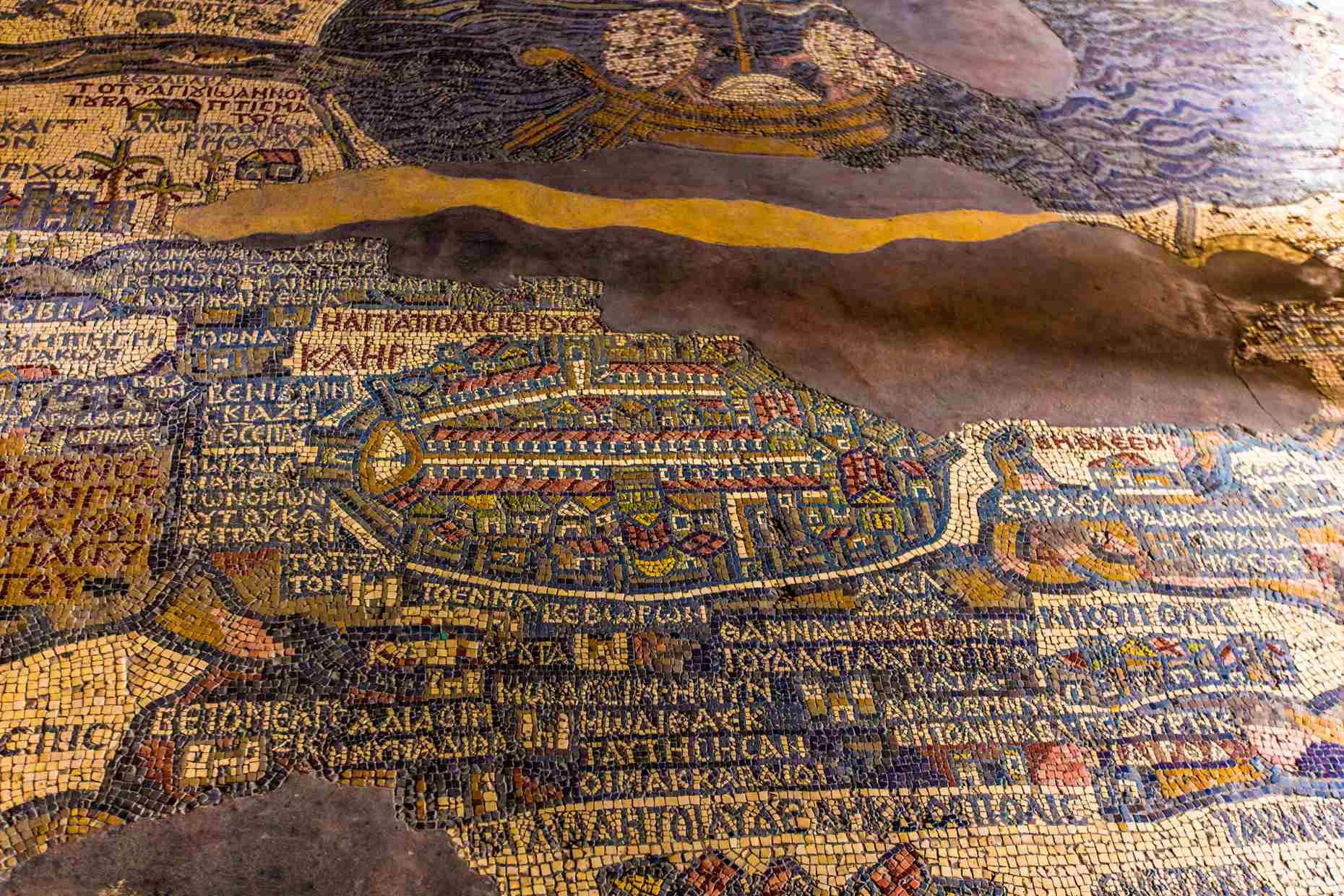
The discovery of the Madaba Mosaic Map
The Mosaic Map of Madaba was accidentally unearthed when the ruins of the old Byzantine church in Madaba were cleared in 1884. Unfortunately, the construction process damaged the mosaic, resulting in the loss of two-thirds of the original map.
Despite this damage, the surviving one-third of the Madaba Map is a remarkable piece of art and historical documentation. The Madaba Map was incorporated into the new church of St. George, Madaba, Jordan.
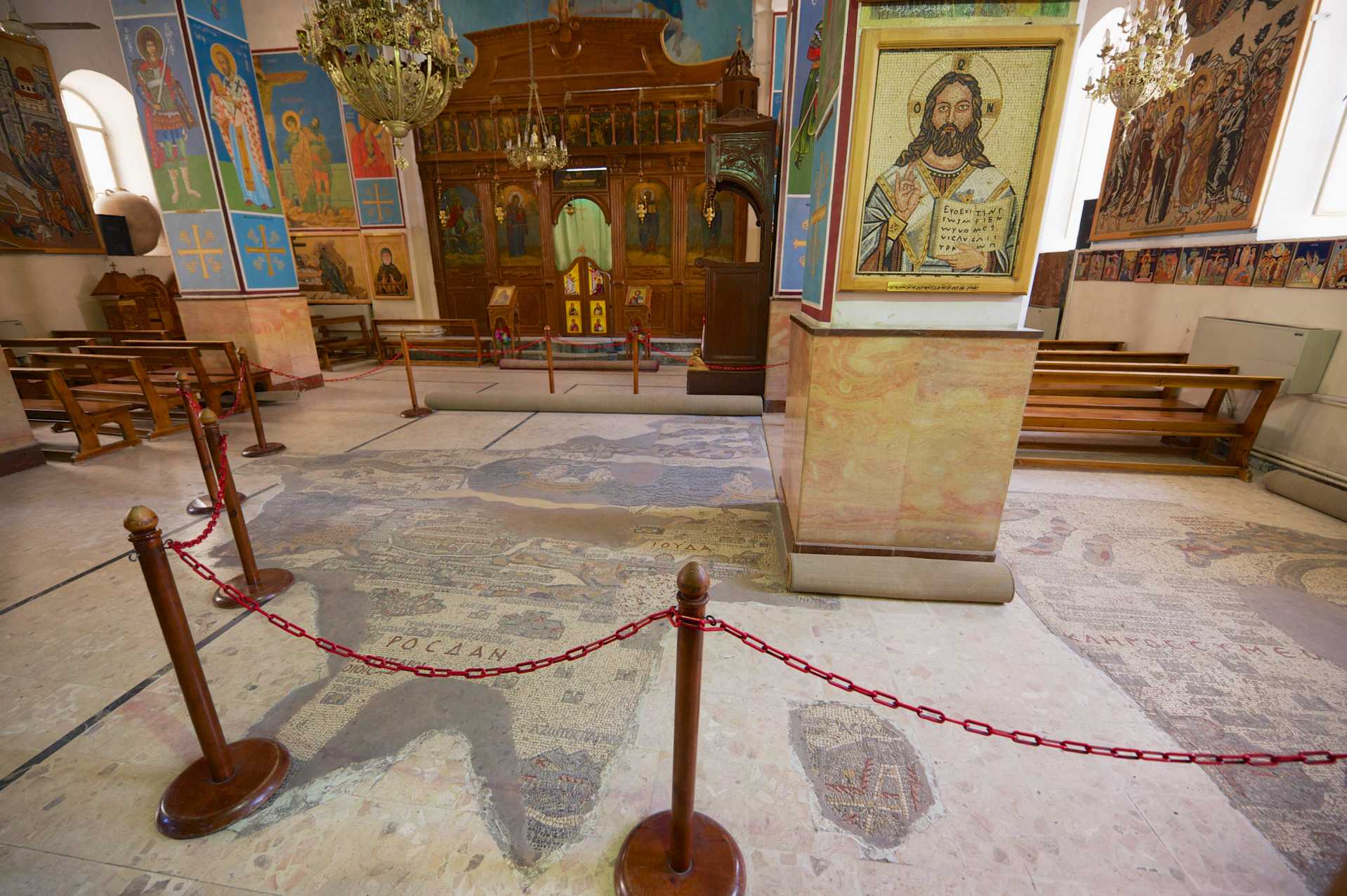
The Madaba Mosaic Map’s cartographic depictions
The Madaba Map is the first known complete aerial view of Palestine and the oldest surviving original geographic representation of floor mosaics in art history, dating back to the sixth century AD.
The map offers a three-dimensional perspective, featuring Greek captions for various locations. Although the focal point of the map is Jerusalem, which helps scholars in dating the mosaic, the map represents a vast historical territory and their sagas.
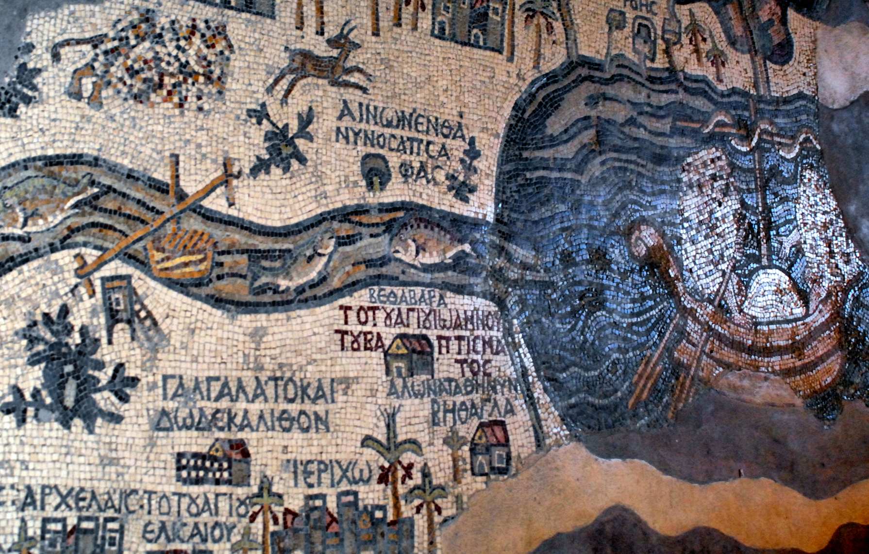
The mosaic depicts a region from Lebanon to the Nile Delta, and from the Mediterranean Sea to the Eastern Desert. It includes features such as a lion hunting a gazelle, biblical-Christian sites like Jericho and Bethlehem, the ancient Jewish town of Modi’in, the Roman city Nicopolis and the Dead Sea with fishing boats, among others.
The mosaic also served as a guide for pilgrims in the Holy Land, with all landscape units labeled in Greek. The inclusion of detailed representations of Jerusalem’s landmarks, such as the Tower of David and the Church of The Holy Sepulchre, further adds to its historical and religious significance.
The artist who created the mosaic likely used the Onomasticon of Eusebius as a primary source, as evidenced by biblical references and toponymy.
The map enhanced the religious experiences
The Madaba region has a strong association with Moses and his journey through the area. This connection suggests that the map may have been intended to enhance the religious experiences of visitors to the region.
The true purpose of the map remains an enigma
The purpose and meaning of the map have long puzzled scholars. Some believe it was created as a visual guide for pilgrims only, while others suggest it may have served a symbolic or educational purpose within the church. Regardless of its original intent, there is no denying the cultural and historical value of the Madaba Map.
The map was officially presented to the public in 1896, sparking widespread fascination and interest. Since then, it has become a popular tourist attraction that draws visitors from around the world.
Restoration and preservation
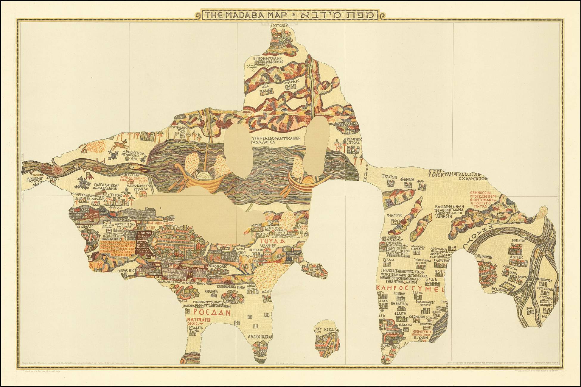
The Madaba Map’s significance extends beyond its geographic representation. It offers valuable insights into the religious, cultural, and historical context of the region during the Byzantine period. Given its age and the damage it has sustained over the years, the preservation and conservation of the Madaba Map are of utmost importance.
Efforts have been made for the restoration and conservation of the remaining sections of the mosaic with funding provided by organizations such as the Volkswagen Foundation in 1964.
There are several recreations of the mosaic worldwide, often placed in the floor of a foyer. Examples include a school in Bonn and the YMCA in Jerusalem.
Final thoughts
In conclusion, despite its incomplete state, the Madaba Map remains the most comprehensive overview of the biblical landscape, standing as a testament to the rich history of the Holy Land and the enduring impact of ancient cartography.
Visiting Madaba and experiencing the map firsthand is a truly awe-inspiring journey through time, allowing people to connect with the past and gain a deeper understanding of the region’s cultural and religious heritage.
Nearby attractions in Madaba include Ma’in Hot Springs, Iraq al-Amir, and the Fortress of Machaerus. Similar mosaics depicting other geographical areas can be found in San Diego, California, Jacksonville, Florida, Berlin, Germany, and Walenstadt, Switzerland.
The Madaba Map is not just a piece of artwork or a relic of the past; it is a living testament to the enduring human fascination with exploration, cartography, and the desire to understand and document our world.
After reading about the Madaba Map, read about The mysterious map of Ptolemy, then read about The Piri Reis Map: Where’s the lost map of Columbus?

