The time ‘before the great flood’ is known as the Antediluvian Period, sometimes known as the pre-flood period. This time period is defined in the Bible as the time between man’s expulsion from the Garden of Eden and Noah’s deluge, as recounted in Genesis. However, comparable legends of a great flood may be found in other religions and stretch back thousands of years, and they are not just contained in the Bible.
In fact, the first records of a huge flood date back to approximately 200 BC, and are found on ancient Sumerian clay tablets. The ancient books not only chronicle antediluvian history, but also talk of man’s genesis and how the “gods” interfered in a remarkable way:
“It had only been twelve hundred years since the Earth’s inhabitants had expanded and multiplied. The earth screamed like a bull, and the deity, startled by its ferocity, heard the commotion”. Then he addressed the great gods, saying: “Humanity’s clamour has gotten too loud for me, and its bustle has deprived me of sleep. Cut off the supply to the cities, and the world will suffer as a result”.

“Adad must keep his rain from falling and send a flood. Allow the wind to blow and hit the land, causing clouds to rise but not warning of severe rain, which would reduce crop yields. There should be no happiness among them.” (From the Mass Market Paperback edition of The Gods of Eden)
It is important to note that, according to the Sumerian tablets, “the gods fled the earth to remain safe in the heavens” shortly before the great flood that devastated the Earth, “only to return after the flood”.
These stories, which scholars of these subjects refer to as “ancient accounts,” indicate that there was a time when different civilizations inhabited our planet, cultures and peoples who lived on Earth before our history was written, a lost period of prehistoric events whose traces we are slowly accumulating today.
But legends of a great flood aren’t the only proof that advanced civilizations existed long before us; there have been a slew of additional findings that back up the hypothesis of Antediluvian civilizations.
The fact that countless artefacts have been unearthed all across the world suggests that history, as we were taught, is incorrect. Scholars have confirmed maps such as Piri Reis’s, but they are perplexed and unable to explain their precision and degree of detail. Some of them were designed as though the terrain could be seen from the air before the maps were drawn.
It is worth noting that the Piri Reis map was inspired by far older maps from many parts of the world. But what can we learn from maps like Piri Reis? They provide strong proof that civilizations with great cartographic knowledge existed on Earth in the remote past.
It appears that these ancient civilizations saw areas of the world that are now covered in ice, such as Antarctica, which indicates that the one who produced these maps must have seen sections of the world where the Earth’s climate was quite different, prior to the last ice age.
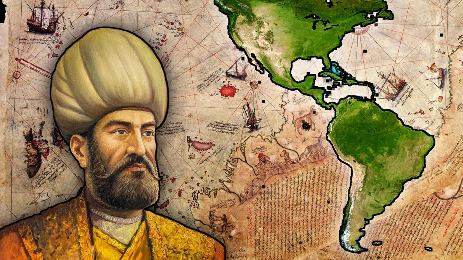
Piri Reis’ map was discovered in 1520, and it not only depicts Antarctica without ice, but it also properly represents the geology of the American continent in such a way that it looks to have been created using aerial pictures. Surprisingly, the US Navy Hydrographic Service reviewed this chart and certified its validity 100 percent.
The validity of the map has been established, and it is so precise that it was allegedly used to fix mistakes in certain current maps. But who, 6,000 years ago, charted the Earth’s share of the East Antarctic sector above the Southern Ocean? What undiscovered civilisation possessed the technology or had the necessity to do so?
The map’s geographic information shows that the original material dates back more than 5,000 years. Although the Piri Reis map was not produced before the great flood, it was created from maps that are over 5,000 years old.
Captain Lorenzo W. Burroughs, head of the USAF, Westover AFB, Massachusetts, writes in an interesting letter about the Piri Resi map:
“The coincidence of the Piri Reis map with the seismic profile of this area made by the British expedition Norwegian in 1949, beyond any reasonable doubt, allows the conclusion that the original source of the maps must have existed before the current ice sheet of Antarctica covered the coasts of Queen Maud’s Land”.
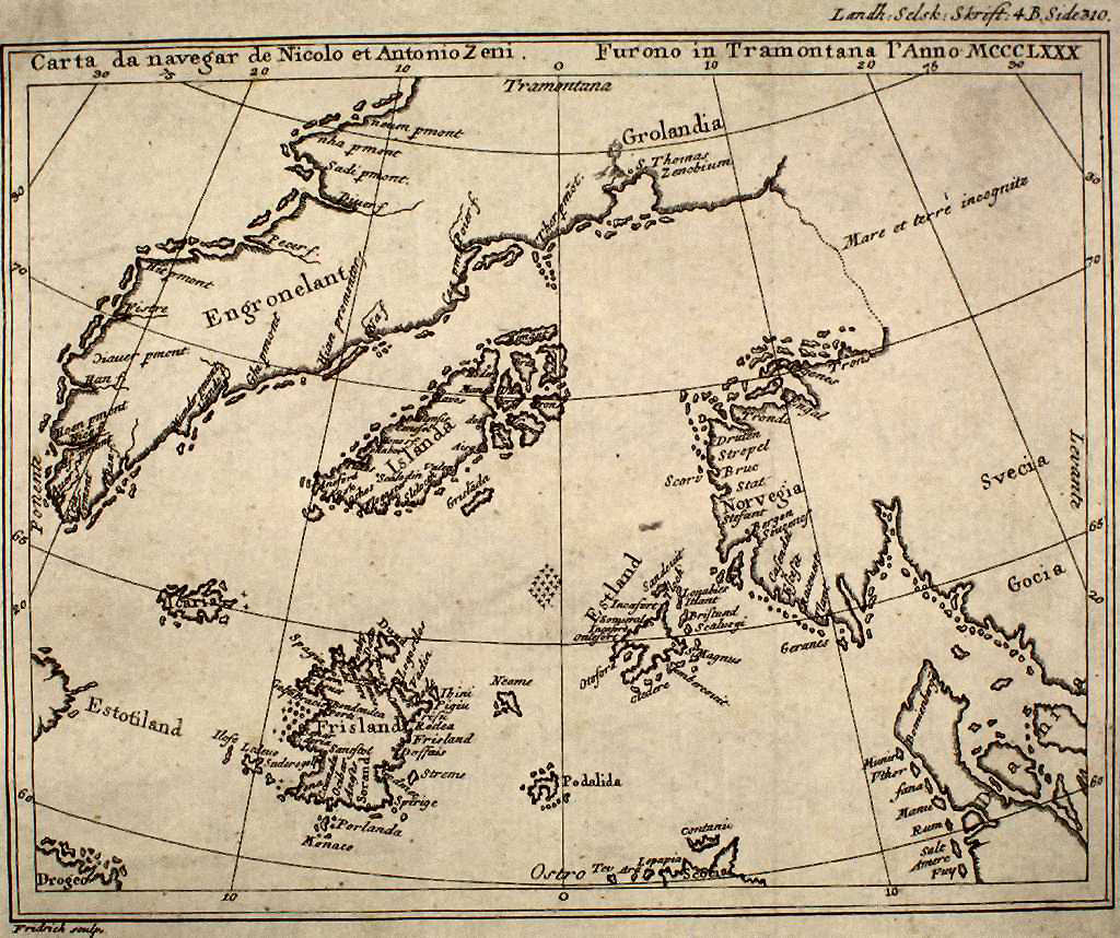
Other maps, such as the Zeno Map, which predates the Piri Reis map and depicts the coastlines of modern-day Norway, Sweden, Denmark, Scotland, and Germany, are more remarkable. Zeno’s chart also shows the precise longitude and latitude of many islands.
Why is it important? There were no equipment available at the time to conduct such precise measurements. Even more incredible, Zeno’s map appears to depict the terrain of modern-day Greenland without glaciers, implying that someone must have visited Greenland before to the ice age.
The knowledge appears to have been passed down from person to person. The navigation charts appear to have originated with unknown people and were transmitted by them; possibly it was the Minoans and Phoenicians, who were the best navigators of antiquity for thousands of years.
Evidence suggests they were gathered and examined in Alexandria’s great library (Egypt), and that compilations of them were created by geographers who worked there. Piri Reis most likely saved the letters because they were at the Library of Alexandria, the most well-known and important library in ancient times. “Dr. Charles Hapgood -Maps of the Ancient Kings of the Sea” (Preface to Turnstone Books, London, 1979).
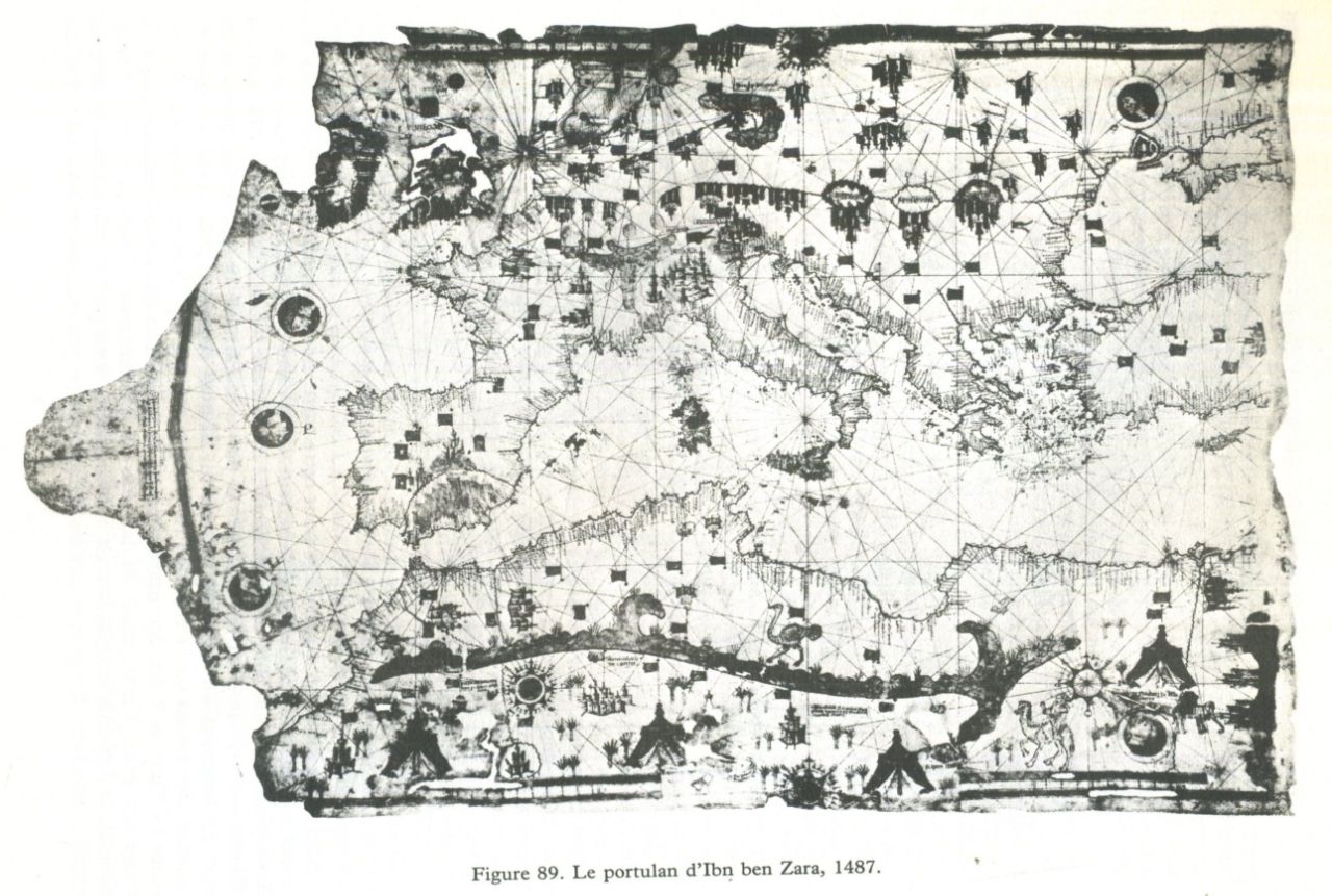
The images made by cartographers Yehudi Ibn Ben Zara are even more intriguing. His map, created in 1487, depicts some snow-covered parts of Brittany. In addition, the map depicts islands in the Mediterranean and Aegean seas. These islands are presently submerged, implying that the charts were created at a time when our planet’s geology was significantly different, maybe prior to the Flood.
These ancient maps raise numerous mysteries and questions, implying that ancient and intelligent civilizations lived on Earth in the distant past, stretching back at least 10,000 to 12,000 years, building great buildings, executing astounding feats, and traversing the world with surprising precision.

